Wheaton, MD -
Montgomery County Police say Henry Levi Sanders, a 50 year old man from Landover, MD is in custody in connection with the three cases. Police had distributed surveillance video allegedly of Sanders from Westfield Wheaton Mall. Sanders has previous charges attached to his name as well. All of the recent incidents occurred at the same mall and involved generally older male victims.

Wednesday, November 30, 2011
Monday, November 28, 2011
PRESS RELEASE: Wheaton Carjacking/Abduction Incidents
The following document is the press release issued by Montgomery County Police with regards to the recent carjacking/abduction incidents in Wheaton, MD. The only changes that we have made are to remove hyperlink formatting from the top of the press release to eliminate confusion (links cannot be clicked as this is an image file).
Continue to check back with The Capital Region Pulse for further updates on this series of crimes.
Continue to check back with The Capital Region Pulse for further updates on this series of crimes.
 |
| This is the press release from Montgomery County Police with regards to the Wheaton Mall incidents in Maryland. |
Third Carjacking/Abduction in Wheaton, MD
Wheaton, MD -
Montgomery County Police are investigating a series of carjackings/abductions that have plagued the Wheaton, MD neighborhood over the last few days. The three cases all involve an older male victim being forced into the vehicle by the suspect. The suspect then forces the victim to travel to various locations and withdraw money from ATM units.
The incidents are originating at the Westfield Wheaton Shopping Mall. Detectives do believe that the same person is responsible for at least the first two incidents. The third that occurred on Sunday is still under investigation.
Police have issued a lookout for an African American man with a medium complexion, between the ages of 35 and 45 years old, 5-foot-11 to 6 feet tall, and about 175 to 180 pounds.
Obviously, if you spot a person that you think is the suspect, you should not attempt to take action. Call police and give them details on direction of travel, clothing description etc. Also, people in the area should be aware of their surroundings.
The Capital Region Pulse will be posting the Montgomery County Police press release for viewing shortly. Stay tuned for further updates and details on this developing crime spree.
Saturday, November 26, 2011
PRESS RELEASE: Man Shot, Killed in Adelphi, MD
As usual, we want our readers to view the raw press releases that come out from local law enforcement and other entities. Therefore, we are posting the official press release that the media division of Prince George's County Police has provided on their website. We have made no edits to the release except for converting it into image format. See the previous post for the original brief on this incident.
 |
| This press release was posted to the PGPD website and has not been altered in any way. |
Man Shot, Killed in Adelphi, Maryland
Adelphi, MD -
Prince George's County Police are looking for three suspects connected to a carjacking and homicide last night in the Adelphi area. Just after 9:00pm, police officers responding to the incident found a male patient suffering from a gunshot wound. This victim was pronounced dead at the hospital.
Police determined that the suspects crashed the victims vehicle and fled the scene. They have not yet been caught.
We will provide updates when Prince George's County Police issue a press release or statement regarding this incident. Stay tuned.
Sunday, August 28, 2011
Irene Leaves Widespread Power Outages in Wake
Many DC area residents are waking up this morning to downed trees and power lines. Meanwhile, Irene has been downgraded to a Tropical Storm as she makes another landfall well north of the Mid-Atlantic region. At this hour, numerous residents remain without power -
BGE - 463,000 outages
PEPCO - 197,000 outages
Dominion - 944,000 outages
Ocean City, MD officials are reporting minimal damage. At last report, they were planning to reopen the city to everyone at 12:00pm (noon) this afternoon.
Stay tuned for further details and updates on the aftermath of Irene.
BGE - 463,000 outages
PEPCO - 197,000 outages
Dominion - 944,000 outages
Ocean City, MD officials are reporting minimal damage. At last report, they were planning to reopen the city to everyone at 12:00pm (noon) this afternoon.
Stay tuned for further details and updates on the aftermath of Irene.
Saturday, August 27, 2011
Hurricane Irene Begins to Impact Area
HURRICANE IRENE IMPACTS DC AREA
Main impacts to be heavy rain and gusty winds
The effects of Hurricane Irene are beginning to be felt in southern and eastern portions of the area. In fact, southern Maryland is already experiencing moderate to at times heavy rainfall. This will continue to overspread the area. One of the big questions is how far west the shield of rain makes it. The best guess at this point is that the worst impacts will be east of the Blue Ridge Mountains. Even then, impacts should be moderate over most of the area. More significant effects may be felt in lower Maryland in areas such as St. Mary's County. They are under a Hurricane Warning. Gusts to 75mph are possible along the water in spots.
Winds should top out around 50mph (gusts) in DC proper. However, these gusts may still be enough to knock down trees and power lines given the heavy rainfall that is also expected. There is also a Flood Watch in effect for the potential of up to 4 inches of rain in parts of the area (locally higher amounts are also possible).
The worst conditions will be felt from late this afternoon into tonight. It is possible that Sunday late morning and afternoon may begin to clear out significantly across the area. The exception may be in extreme northeastern parts of the area. Stay tuned for the latest details and updates. Currently, the 9:00am update is broadcasting on our Livestream channel. You may view that video above.
Thursday, August 25, 2011
Hurricane and Tropical Storm Watches Posted
HURRICANE IRENE THREATENS E. COAST
The National Weather Service has posted a Hurricane Watch for a large chunk of the eastern seaboard. At the same time, a Tropical Storm Watch has been posted for the Chesapeake Bay and Tidal Potomac River. This means that hurricane/tropical storm conditions are possible. Continues reading for detailed information.
A MANDATORY evacuation of Ocean City, MD has been ordered. This evacuation order will go into effect at midnight tonight and all residents are expected to evacuate by 5:00pm tomorrow evening. This includes ALL visitors/tourists. The city will close to any unauthorized personnel tomorrow at 5:00pm.
Sandbags are being made available in certain jurisdictions along the Tidal Potomac. Also, evacuations are in place in many locations from the Outer Banks of North Carolina into New Jersey. Stay tuned for the latest updates and details.
The Capital Region Pulse Livestream
Watch live streaming video from capitalregionpulse at livestream.com
Hurricane Irene Threatens East Coast
Hurricane Irene churned off of the southeast coast of the United States Thursday morning. Irene is expected to continue in a northwesterly direction and then change to a northerly direction with time. There is some uncertainty as to where the storm will ultimately end up. However, there has been some shift west with the computer model tracks. Also, Ocean City, MD has started phase one of their emergency plan. They are evacuating international workforce students and asking visitors to postpone trips.
For the DC area, it is unclear how much Irene will impact the area. Please stay tuned to this website AND our Livestream for the most up to date information. We will continue to update our readers with time. Please note that we expect to schedule some live broadcasts using our Livestream channel within the next day or two.
For the DC area, it is unclear how much Irene will impact the area. Please stay tuned to this website AND our Livestream for the most up to date information. We will continue to update our readers with time. Please note that we expect to schedule some live broadcasts using our Livestream channel within the next day or two.
Monday, June 13, 2011
Bomb Threat Disrupts Metro Red Line
Rockville, MD -
Montgomery County Police and other local authorities are wrapping up an investigation after a female Metro passenger made a bomb threat as she exited a Red Line train. According to some witnesses, the woman dropped to her knees in prayer after speaking to somebody on the phone. There were unconfirmed reports that she had just heard about a Muslim bombing in India.
Police have checked the rails and the impacted train and have found no evidence of an actual bomb. The investigation will be wrapping up shortly and service should return to normal as the morning continues.
There are new details emerging with time and we urge our readers to stay tuned for further updates. We are currently attempting to contact Montgomery County officials for a comment.
Saturday, April 16, 2011
Storms with Damaging Winds Possible Today
There will be a risk for severe thunderstorms this afternoon and evening across a large swath of the eastern United States. The risk will be greatest in the Carolina States where there could even be isolated intense tornadoes.
For the Washington, DC area, moderate to at times heavy rainfall will continue this morning before a brief lull later on this morning and early afternoon. A warm front may provide the necessary instability for storms to develop to the west. These storms will intensify and move east during the afternoon hours and into the early evening. Below, you can see one weather models prediction for this evening -
For the Washington, DC area, moderate to at times heavy rainfall will continue this morning before a brief lull later on this morning and early afternoon. A warm front may provide the necessary instability for storms to develop to the west. These storms will intensify and move east during the afternoon hours and into the early evening. Below, you can see one weather models prediction for this evening -
 |
| This weather model shows an intense line of thunderstorms for the area late this afternoon. |
Wednesday, March 2, 2011
Park Police Officer in Serious Accident
WTOP is reporting that a park police officer has been involved in a serious accident. Stay tuned for more information.
The officer was allegedly on a motorcycle. This is reported to be on the SE SW Freeway.
Sent on the Sprint® Now Network from my BlackBerry®
The officer was allegedly on a motorcycle. This is reported to be on the SE SW Freeway.
Sent on the Sprint® Now Network from my BlackBerry®
Friday, February 25, 2011
HIGH WIND WARNING - Widespread Power Outages
High Wind Warning
High winds bring power outages and damage to area
Significant wind gusts to 60mph are raking over the area at this hour. PEPCO, BGE, and Dominion are all beginning to report power outages across their service territories. For the time being, it appears as though PEPCO and BGE are being hit the hardest with 5-6,000 outages in each of those territories. Please stay tuned. Most updates will be posting to our Twitter and Facebook!
Friday, February 18, 2011
Warm Today - High Wind Watch Tomorrow
 |
| Areas in brown are under a High Wind Watch for tomorrow. |
Temperatures today will climb into the lower 70s across most the of the region. However, tonight, a cold front will trek through the area and start to lower temperatures. The lows tonight will be in the 40s. Tomorrow, owing to a strong pressure gradient behind the front, strong winds will become a hazard.
The National Weather Service has posted a High Wind Watch highlighting the potential for gusts up to 60mph in some areas. Winds of this magnitude can rival severe thunderstorm wind gusts. This has the potential to be a hazardous situation with downed trees and power lines. It is important that you stay tuned to your local media, The Capital Region Pulse and other weather providers for the latest information and updates.
Never go near downed power lines and always drive with extra caution during high winds. Strong winds can shift your car unexpectedly on the road.
Stay tuned, we will continue to provide updates.
Thursday, February 17, 2011
Stink Bug Invasion - How to Ease the Pain
For a few summers, the number of stink bugs (also known as shield bugs) has been slowly increasing in the Washington area. However, last summer the numbers took a dramatic rise. Last summer the area was invaded by tons of the resilient winged creatures. They crawl or fly through small cracks in your house, through holes in screened windows and more. Over the winter, it is likely that they have even been hibernating in the warmth of your houses walls.
The question becomes - How do I prevent the little armored vehicles from getting into my house in the first places? Keep reading to find out!
STINK BUG PREVENTION
1) Replace or repair any screens that have holes in them. Clean out the areas between windows and screens of any natural debris.
2) Caulk any cracks in your home that you can find. You may want a professional to do this if you don't have the tools of knowledge.
3) If you see a stink bug inside your house, try not to smash it (this releases the foul smell from their glands). The best option is to capture them and either put them back outside or dispose of them another way. DO NOT vacuum them with your normal vacuum...they will stink the bag/cup up as well.
4) The USDA is currently testing a "Stink Bug Trap" that will likely hit the shelves this spring. It contains an attractant that will draw stink bugs into the trap. The trap will supposedly work very similar to a yellow jacket trap. If you decide to use this, it's best to place it a little ways away from your home.
5) THE CHEMICAL APPROACH - Many online pest control dealers sell a product called "Cyonara 9.7." This product is potent yet harmless to non-insect creatures once it is dry. There are also other products called "Demand CS" and "Demon WP" that will work as well. However, some of these may leave a white film on dark surfaces. Cyonara 9.7 does not leave this film.
If you decide to go this route, you will need a sprayer (we recommend Chapin). One bottle of this stuff is over 30 dollars but you can make quite a bit of solution to last you 1+ years. This is mainly used for an outside barrier treatment and you can go along the entire perimeter of your house and spray a continuous barrier. Also spray outside window sills and any other areas/cracks where stink bugs may enjoy hiding. Don't overdo the spraying as this chemical is highly toxic to fishes if it gets into the water system before it dries.
This product has had excellent results for many people. Not to mention it works on spiders, ants and just about everything else as well. It lasts for up to 3-4 months in good weather and a bit less in rain or extremely hot weather. Periodically retreat using the same steps above and you'll notice MUCH fewer bugs getting in.
6) Another thing you should do is clear any close hanging tree branches or yard debris from your house. If a branch is touching your house, this allows bugs easy access to your property. One branch touching can equal many bugs making contact with your house.
7) A NATURAL APPROACH - If you want to take the time for a natural approach, buy a BAT BOX. These are homes for up to 300 bats in some cases. It might take a while to attract them (place the box far away from your house but still reasonably close). Bats love to eat all insects and will gobble up stink bugs as well.
WHAT IF I ALREADY HAVE STINK BUGS?
It's important to follow good disposal procedures for bugs that are already in your house. Similar to the way smashed bees can attract other bees to that location, stink bugs have a similar chemical in their bodies to attract more stink bugs. DO NOT smash the stink bug. Either capture it and release it outside, or carefully capture it and flush it down the toilet. If you have more than a few stink bugs and want to save water, keep a bowl of soapy water handy and drop the live stink bugs in there, they won't last very long and then you can dispose of them all at once.
Also, sticky fly traps can also work somewhat well in areas where lots of stink bugs are already present. Some people have said that spraying them with a quick spritz of rubbing alcohol will do the trick as well.
BOTTOM LINE
As much of an annoyance as these creatures are, they are harmless to humans for the most part. They can eat crops and plants, however, so they post a real threat to farmers and home gardeners.
Do you have your own methods for battling the stink bug invasion? WE WANT TO KNOW!
Send us an email at CapRegPulse@gmail.com or message us on Twitter, or Facebook. If you're feeling lazy, you can also leave us a comment on this article!
Wednesday, February 9, 2011
Methane Gas Forces Evacuations in Stafford Co.
Stafford County, VA -
Several families in the Woodstream community of Stafford County have been evacuated from their homes today after high concentrations of methane were detected. Sources say that concentrations as high as 60 percent have been found. Experts say that concentrations as low as 5 percent can be explosive.
The methane has been detected in the soil and there are currently no reports that the gas has high concentrations in the air as well. The fire department is continuing to monitor while the families have been temporarily relocated to a hotel.
Officials also say that power has been shutoff to some houses as a general precaution. Stay tuned for further updates.
The Capital Region Pulse - Viewership
Just a quick posting to show where our readers reside.
 |
| United States readers of The Capital Region Pulse. (for the two past weeks ending today) |
 |
| DC area readers of our website for the two week period ending today. |
Montgomery Co. Police Investigate Homicide
Silver Spring, MD -
Montgomery County Police are investigating an apparent homicide that occurred last night in Silver Spring, MD. The body of the deceased female was discovered early this morning by police who were responding to a 911 call from a pay phone. The 911 call featured an anonymous male caller who told the operator that he had killed his wife several hours earlier.
It was later discovered that the callers name was Bernardo Paz-Flores-Olvera, who is 32 years old.
As always, we want our readers to see the unabridged information. Unlike most media sources, we post the raw press releases on our website. You may view the press release below. Stay tuned for any updates to this story.
Tuesday, February 8, 2011
Greencastle Elementary School Teacher Arrested
Silver Spring, MD -
Montgomery County Police have arrested Susan Lee Burke of the 9300 block of Decatur St. in Laurel, MD for allegedly abusing children in her first grade class. Court documents reveal that a warrant was issued on February 3rd for nine counts of assault in the second degree. The documents also reveal that the alleged assaults took place during the period from December 1st to December 31st of last year.
As always, we want our readers to be able to review the unabridged information. Unlike most other news sources, we post the raw press release from Montgomery County Police. The court information is in the public record on the Maryland Judiciary System website.
 |
| Susan Lee Burke |
Wednesday, January 26, 2011
Extremely Dangerous Road Conditions - LIVE Blogging (continued)
***Winter Storm Warning Remains in Effect***
Extremely Dangerous Road Conditions Exist
6:40pm EST - (PHOTO Post)
6:15pm EST -
5:45pm EST -
 |
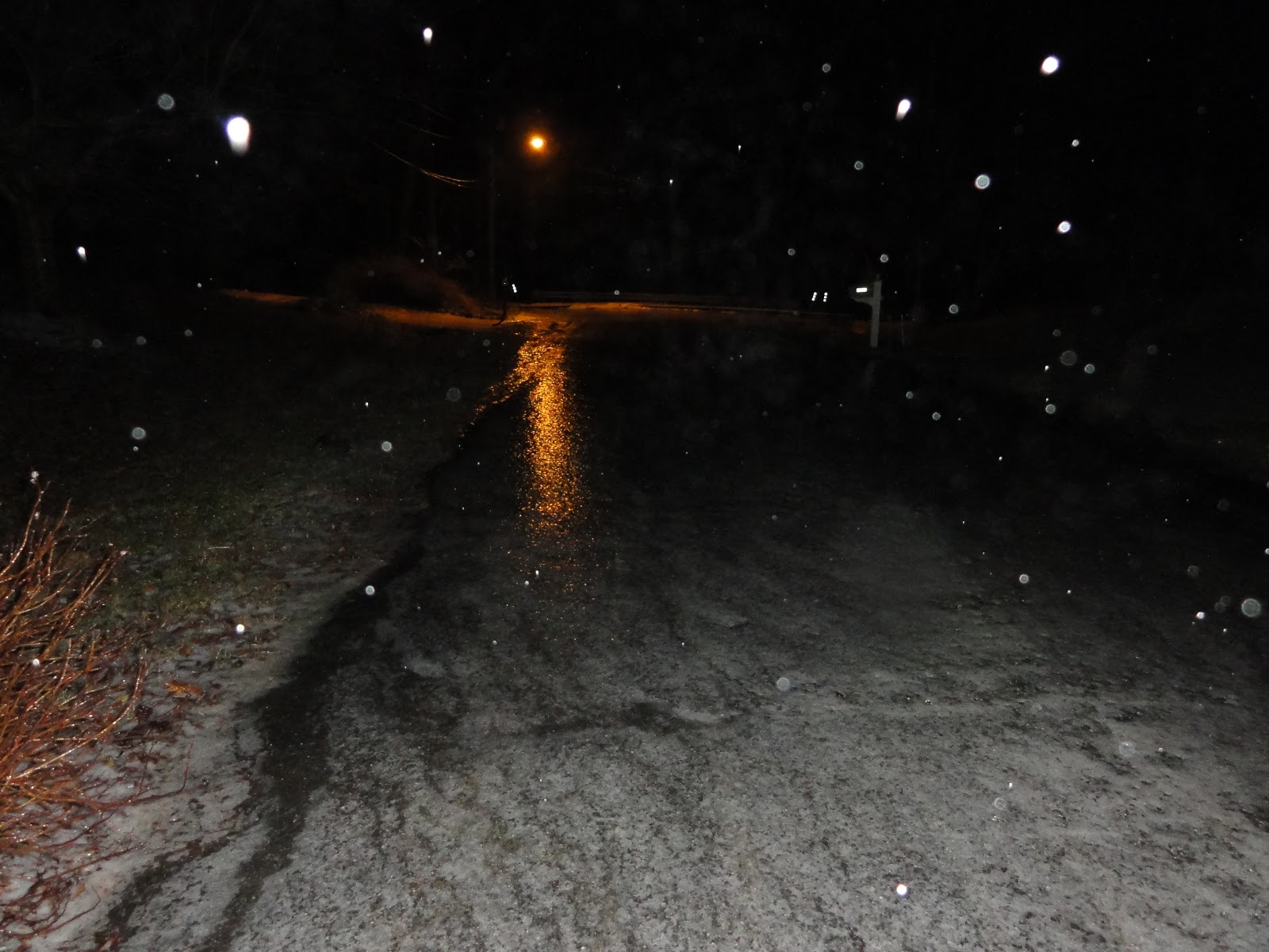
| Snow sticks to bushes in Maryland (Photo By: Kenneth Lorber) |
 |
| A snow blurred photo taken in Colesville, MD (Photo By: Kenneth Lorber) |
 |
| Snow accumulation on a garden light. (Photo By: Kenneth Lorber) |
 |
| Heavy snowfall continues to impact the DC area. (Photo By: Kenneth Lorber) |
 |
| A snowy scene in Montgomery Co. Maryland (Photo By: Kenneth Lorber) |
6:15pm EST -
Again, if you have photos of the snowfall please SUBMIT THEM to us at CapRegPulse@gmail.com
We will post photos to our website from the DC area!
Reports of many Montgomery County emergency vehicles getting stuck are coming into our news center. Please drive cautiously. It is likely if you require an emergency service that the wait time will be significant. Please be cautious.
5:45pm EST -
LIVE blogging will continue right here on The Capital Region Pulse!
Please use extreme caution when driving around tonight.
Winter Storm Warning - LIVE Blogging/Coverage
***Winter Storm Warning for Metro Area***
Major Snowfall Accumulations Expected
4:50pm EST - (PHOTO Post)
4:40pm EST - (Update 5)
4:05pm EST - (Update 4)
3:15pm EST - (Update 3)
2:35pm EST - (Update 2)
1:45pm EST - (ORIGINAL POST)
 |
| Snow rapidly accumulates in Colesville, MD (Photo By: Kenneth Lorber) |
 |
| Snow sticks to trees, roads and all surfaces in Maryland. (Photo By: Kenneth Lorber) |
4:40pm EST - (Update 5)
Heavy snow is occurring over most of the area (exception is east of I-95). Roads are quickly becoming snow covered and dangerous. Many accidents have been reported.
 |
| Valley Brook Drive at New Hampshire Ave. - Roads are hazardous and slippery. (MCDOT) |
4:05pm EST - (Update 4)
Sleet has begun to changeover to all snow here in Silver Spring, MD. There have been reports of very heavy snow just to the southwest of the area. All of this activity is now expected to continue into the evening. Heavy accumulations of 4 to 8 inches are expected.
If you have any weather photos of the storm from the DC area - send them to CapRegPulse@gmail.com
Follow us on Twitter @CapitalRegPulse and visit our Facebook page to never miss an update!
We will begin posting photos from Silver Spring in the next few updates.
3:15pm EST - (Update 3)
Thunder and lightning have been reported in parts of Fairfax County, VA! Sleet and rain will quickly change to snow and become heavy at times as bands of heavy precipitation develop and move through the area. Expect snowfall rates of 1-2 inches per hour at times into the evening hours. Latest data indicates peak snowfall period may only be 6 hours long but heavy accumulations expected during that time.
The evening commute is expected to be extremely dangerous across the area. Please drive carefully and watch all vehicles around you. Obey traffic laws and stay alert.
Storm total accumulations in the heaviest bands should be from 5-10 inches with a general 4-8 inch total elsewhere. We are currently expecting numerous school delays/closures tomorrow so stay with The Capital Region Pulse for the latest information!
2:35pm EST - (Update 2)
Weather conditions will rapidly deteriorate across the Washington area within the next one to two hours. Heavy snowfall with rates possibly reaching two inches per hours will become probable. A Winter Storm Warning remains in effect into tonight for the potential of major snowfall accumulations. It is possible that the snow may start as sleet or rain for a short period before changing to all snow.
Residents should be prepared for possible hazardous road conditions this afternoon and evening. Keep in mind that the federal government has allowed a two hour early closing.
 |
| Heavy bands of precipitation can be seen moving up from the south. |
1:45pm EST - (ORIGINAL POST)
The Capital Region Pulse weather team is currently forecasting between five and nine inches of snow for the area...some higher totals will be possible in the heaviest bands.
Thundersnow will be possible with incredible snowfall rates during the heart of the storm. Don't be surprised if roads QUICKLY become impassable and extremely hazardous.
We will continue to have the latest information as it becomes available!
Tuesday, January 25, 2011
Winter Storm Watch in Effect - Significant Snow on the Way
Just a quick post to update everyone on the current snow situation -
The afternoon models are running right now and they seem to be holding onto the idea of significant snow for the Washington area tomorrow afternoon into tomorrow evening. The 18z NAM model clearly shows some significant energy on the 500mb map. For the lay people reading this posting - the 500mb level is high in the atmosphere, and maps from this part of the atmosphere are useful in diagnosing where certain features are.
This map would indicate a strong chance for snow in our area - more later.
The afternoon models are running right now and they seem to be holding onto the idea of significant snow for the Washington area tomorrow afternoon into tomorrow evening. The 18z NAM model clearly shows some significant energy on the 500mb map. For the lay people reading this posting - the 500mb level is high in the atmosphere, and maps from this part of the atmosphere are useful in diagnosing where certain features are.
 |
| 500mb level map from the 18z NAM model. Strong indicator of the potential of snow in our area. |
This map would indicate a strong chance for snow in our area - more later.
Metro Area Braces for Winter Blast
The National Weather Service has issued a *Winter Storm Watch* for tomorrow afternoon into tomorrow night. Snowfall accumulations of five or more inches are possible with this winter storm.
LIVE winter storm coverage will begin on our Livestream channel at 8:00pm EST tonight. We will continue to post updates to our Twitter page, and Facebook page as well.
Beginning during the day tomorrow, we will begin live blogging on this website as well. Tune in for the latest winter storm information!
Tuesday, January 18, 2011
Winter Proves Itself in DC Area
The Washington area is thawing out from an ice storm last night! Icy conditions remain on some area roads, but most of the main roads are wet. Neighborhood roads are by far the most treacherous, and may not have been treated yet. Therefore, please continue to use caution when out and about today.
Temperatures remain at or below freezing in some areas north and west of the I-95 corridor. A few snow showers and rain showers are possible tonight with lows in the lower 30s or possibly upper 20s in a few spots. There could be a few delays tomorrow morning but more than likely the story will be on-time school arrivals.
The Capital Region Pulse has concluded live blogging for this event. We would like to thank all of our readers for checking in and using our website as your source.
To see photos of the storm please scroll down to the previous postings below!
Watch out for a possible snowy situation on Thursday night and Friday morning! We will have more on that as we draw closer to the event.
Winter Mess for DC Area - LIVE Posting
7:50am EST -
***Region Begins to Recover from Substantial Ice Event***
 |
| Part of a plant is encased in ice in Silver Spring, MD (Photo By: Kenneth Lorber) |
The Capital Region is awakening to a decent glaze of ice that accumulated last night. The most significant icing is to the north and west of the I-95 corridor. Some areas picked up close to a third of an inch of ice accretion! Luckily, power outages have managed to stay in the low range and only a few hundred customers from each power company are reporting issues.
Neighborhood roads remain extremely treacherous while main roads are improving or even simply wet in some areas due to heavy treatment.
PRINCE GEORGE'S COUNTY SCHOOLS - NOW CLOSED (had been delayed)
The full list of school closings can be found in the post below. Please note that some of the schools may be updating from "delayed" to "closed." Please double check all information with your school district's website.
 |
| Neighborhood roads are hazardous and icy across the area. (Photo By: Kenneth Lorber) |
5:55am EST -
***Precipitation Ending but Icy Conditions Remain***
Although the precipitation is ending across the area, numerous icy roadways remain - especially in neighborhoods. Below, you will find a full list of closings and delays.
Arlington Co Schools - VA - Open 2 Hours Late
Clarke Co Schools - VA - Closed
Fairfax Co Schools - VA - Closed
Falls Church City Schools - Code Green
Fauquier Co Schools - VA - Closed
Frederick Co Schools - VA - Closed
Fredericksburg City Schools - VA - Open 2 Hours Late
King George Co Schools - VA - Open 2 Hours Late
Loudoun Co Schools - VA - Closed
Manassas City Schools - VA - Closed. Code Gray.
Manassas Park Schools - VA - Closed
Orange Co Schools - VA - Closed
Page Co Schools - VA - Closed
Pr William Co Schools - VA - Closed; Code Red
Shenandoah Co Schools - VA - Closed
Spotsylvania Co Schools - VA - Closed
Stafford Co Schools - VA - Code 2
Warren Co Schools - VA - Closed
Winchester Public Schools - VA - Closed
Also, the Federal Government will open two hours late with unscheduled leave. Please refer to the OPM website for more information on this.
***Hazardous Driving Conditions Areawide***
Even though the freezing rain has stopped in many areas, hazardous conditions remain widespread.
Although main roads are generally being heavily salted and remain only somewhat icy, neighborhood streets are a different story. Also, a few power outages have been reported where the ice is heaviest. Roadways that are not heavily traveled are sheets of solid ice in parts of the area, mainly west of the Interstate 95 corridor.
Although the precipitation is ending across the area, numerous icy roadways remain - especially in neighborhoods. Below, you will find a full list of closings and delays.
MD Public Schools
Allegany Co Schools - MD - Open 2 Hours Late
Anne Arundel Co Schools - Closed Employees liberal leave.
Calvert Co Schools - MD - Open 2 Hours Late
Carroll Co Schools - MD - Closed
Charles Co Schools - MD - Closed Code 2
Frederick Co Schools - MD - Closed
Howard Co Schools - MD - Closed PM Activities Cancelled
Montgomery Co Schools - MD - Closed
Prince George's Co Schools - MD - Open 2 Hours Late Central Office 1 hr late
Queen Anne's Co Schools - MD - Open 1 1/2 Hours Late
St. Mary's Co Schools - MD - Open 2 Hours Late Code 1. No AM K.
VA Public Schools
Alexandria City Schools - Code Green Arlington Co Schools - VA - Open 2 Hours Late
Clarke Co Schools - VA - Closed
Fairfax Co Schools - VA - Closed
Falls Church City Schools - Code Green
Fauquier Co Schools - VA - Closed
Frederick Co Schools - VA - Closed
Fredericksburg City Schools - VA - Open 2 Hours Late
King George Co Schools - VA - Open 2 Hours Late
Loudoun Co Schools - VA - Closed
Manassas City Schools - VA - Closed. Code Gray.
Manassas Park Schools - VA - Closed
Orange Co Schools - VA - Closed
Page Co Schools - VA - Closed
Pr William Co Schools - VA - Closed; Code Red
Shenandoah Co Schools - VA - Closed
Spotsylvania Co Schools - VA - Closed
Stafford Co Schools - VA - Code 2
Warren Co Schools - VA - Closed
Winchester Public Schools - VA - Closed
Also, the Federal Government will open two hours late with unscheduled leave. Please refer to the OPM website for more information on this.
***Hazardous Driving Conditions Areawide***
Even though the freezing rain has stopped in many areas, hazardous conditions remain widespread.
 |
| Some of the main roadways are generally passable with only some slick spots. (MCDOT) |
 |
| Icicles on the traffic camera at New Hampshire Ave and Ednor Road. (MCDOT) |
2:00am EST -
***Significant Ice Storm Impacting the DC Area***
The Capital Region Pulse continues to track the winter storm that is currently impacting the Capital Region. Significant icing has already occurred in some areas along with sleet and snow accumulation as well. Roadways are extremely hazardous areawide with the worst conditions being west of I-95.
Several schools have already posted delays or closings and those two school systems can be seen in the update below. They are Alexandria City Schools and Prince William County Schools.
 |
| A neighborhood road in Montgomery Co, MD is solid ice. |
Stay tuned for continuing updates on this hazardous situation. Remember, only travel if absolutely necessary. The conditions will improve after sunrise but may remain hazardous north and west of the city. An icy commute is a near certainty. Many schools will likely delay or even close in some areas.
12:20am EST -
PLEASE SEE PREVIOUS POST FOR EARLIER UPDATESA Winter Storm Warning continues for areas just north and west of Washington. A wintry mess is developing on the roadways across the region. Earlier reports indicated that I-95 had been closed in the area of Triangle, VA. In addition, a few school closings and delays are already beginning to trickle into the newsroom here at The Capital Region Pulse HQ.
- Alexandria City Schools - 2 Hour Delay
- Prince William Co. Schools - CLOSED
Icing of over a quarter inch is possible in some areas mainly north and west of the I-95 corridor. Elsewhere, icing should remain below a quarter inch, but will still be enough to cause serious travel problems.
Although salting crews are actively treating roadways, some roads continue to be hazardous.
 |
| Icy roads are common in the area. (Photo Courtesy MCDOT) |
Monday, January 17, 2011
Icy Conditions Impacting Area - (LIVE Posting)
11:15pm EST -
PRINCE WILLIAM CO. SCHOOLS - CLOSED TOMORROW
Prince William Co. School officials have just announced they will be closed tomorrow (11/18) due to the winter weather that is currently impacting the region. Stay tuned for continuing updates.
11:10pm EST -
ALEXANDRIA CITY SCHOOLS - 2 Hour Delay for Tomorrow
Heavy sleet is falling in parts of the area right now. Areas farther to the south and east have changed over to freezing rain with a little sleet mixing in. There are still reports of mainly snow to the north and west.
The Capital Region Pulse weather team is anticipating more and more schools to delay and close tomorrow or late tonight. Stay tuned to our website for the latest on these updates. We will also have a steady stream of pictures and updates on our site RIGHT HERE!
Watch our Twitter, Facebook and website for the more up to date information.
10:45pm EST -
The Winter Weather Advisory for PARTS of the DC area has been UPGRADED to a Winter Storm Warning.
The upgrade DOES NOT include DC proper but DOES include areas JUST to the north and west of the city. This includes Montgomery, Frederick, and other North Central Maryland counties. The National Weather Service now is forecasting two to three tenths of an inch of freezing rain (this is significant).
Isolated power outages will become possible if the higher amounts are realized. Sleet and freezing rain will continue until a changeover in a few hours to all freezing rain. DO NOT travel unless required. Travel will become very hazardous as the night continues.
Stay tuned to The Capital Region Pulse for updates on school closings and delays.
10:30pm EST -
The mixed bag of precipitation continues across the area. Lots of reports now coming in of dicey conditions on sidewalks and side streets. Montgomery Co. DOT seems to be on top of the situation at this hour with salt crews even treating some neighborhood roads.
10:15pm EST -
A mixture of sleet, freezing rain, and snow is continuing in the DC Metro area. The Capital Region Pulse weather team expects this mixing to continue for the next hour or two before the predominate precipitation type becomes freezing rain (ice).
No significant school closures have been reported yet, but stay tuned! Lots of accidents and power outages being reported to the east of the metro area in Anne Arundel County.
(Original Post)
The National Weather Service has issued a Winter Weather Advisory for the entire DC Metro area. Freezing rain, sleet, and snow will impact the area this evening before changing over to all freezing rain later. Moderate amounts of ice are possible. Stay tuned for the latest information.
PRINCE WILLIAM CO. SCHOOLS - CLOSED TOMORROW
Prince William Co. School officials have just announced they will be closed tomorrow (11/18) due to the winter weather that is currently impacting the region. Stay tuned for continuing updates.
11:10pm EST -
ALEXANDRIA CITY SCHOOLS - 2 Hour Delay for Tomorrow
Heavy sleet is falling in parts of the area right now. Areas farther to the south and east have changed over to freezing rain with a little sleet mixing in. There are still reports of mainly snow to the north and west.
The Capital Region Pulse weather team is anticipating more and more schools to delay and close tomorrow or late tonight. Stay tuned to our website for the latest on these updates. We will also have a steady stream of pictures and updates on our site RIGHT HERE!
Watch our Twitter, Facebook and website for the more up to date information.
10:45pm EST -
The Winter Weather Advisory for PARTS of the DC area has been UPGRADED to a Winter Storm Warning.
The upgrade DOES NOT include DC proper but DOES include areas JUST to the north and west of the city. This includes Montgomery, Frederick, and other North Central Maryland counties. The National Weather Service now is forecasting two to three tenths of an inch of freezing rain (this is significant).
Isolated power outages will become possible if the higher amounts are realized. Sleet and freezing rain will continue until a changeover in a few hours to all freezing rain. DO NOT travel unless required. Travel will become very hazardous as the night continues.
Stay tuned to The Capital Region Pulse for updates on school closings and delays.
10:30pm EST -
The mixed bag of precipitation continues across the area. Lots of reports now coming in of dicey conditions on sidewalks and side streets. Montgomery Co. DOT seems to be on top of the situation at this hour with salt crews even treating some neighborhood roads.
 |
| Snow and sleet fall in Montgomery Co, Maryland around 10:30pm on Monday night. |
10:15pm EST -
A mixture of sleet, freezing rain, and snow is continuing in the DC Metro area. The Capital Region Pulse weather team expects this mixing to continue for the next hour or two before the predominate precipitation type becomes freezing rain (ice).
No significant school closures have been reported yet, but stay tuned! Lots of accidents and power outages being reported to the east of the metro area in Anne Arundel County.
(Original Post)
The National Weather Service has issued a Winter Weather Advisory for the entire DC Metro area. Freezing rain, sleet, and snow will impact the area this evening before changing over to all freezing rain later. Moderate amounts of ice are possible. Stay tuned for the latest information.
Friday, January 7, 2011
A Little Snow Tonight? - Winter Weather Advisory Posted
The National Weather Service has posted a Winter Weather Advisory effective from 1:00am tonight until 1:00pm tomorrow afternoon. One to three inches of snow is possible as a system moves through the area. There could be a little more than that north and east of Baltimore, where up to 4 inches is possible according to the weather service.
 |
| The areas in purple are under a Winter Weather Advisory from 1am tonight until 1pm tomorrow. |
Tuesday, January 4, 2011
Mega Millions Jackpot Soars - Long Lines Form at Retailers
Baltimore, MD (Capital Region Pulse) -
The Mega Millions drawing on New Year's Eve failed to produce a winner. The jackpot for tonight was originally announced to be around $290 million, but with robust ticket sales climbed to $330 million. Further, this afternoon, Mega Millions announced that ticket sales had kept up their pace. The current estimated jackpot for the drawing tonight is $355 million!
Washington area residents flocked to the nearest lottery ticket seller for their chance to win big. All of the locations The Capital Region Pulse checked today were bustling with customers. Colesville Beer and Wine in Silver Spring, MD had quite the line during the afternoon hours on Tuesday.
Dominic's Pizza, also in Silver Spring hosted the normal Tuesday crowd with the addition of hopeful lottery players. It seems as though everyone is leaping at the chance to win this near-record jackpot.
So what would you do with the money? Discuss it in the comment section below or on our Facebook Page. For those of you trying your luck tonight, good luck!
 |
| The lottery machine at Dominic's Pizza stands at the ready on the eve of a $355 million jackpot. (Photo by Kenny Lorber) |
Washington area residents flocked to the nearest lottery ticket seller for their chance to win big. All of the locations The Capital Region Pulse checked today were bustling with customers. Colesville Beer and Wine in Silver Spring, MD had quite the line during the afternoon hours on Tuesday.
Dominic's Pizza, also in Silver Spring hosted the normal Tuesday crowd with the addition of hopeful lottery players. It seems as though everyone is leaping at the chance to win this near-record jackpot.
So what would you do with the money? Discuss it in the comment section below or on our Facebook Page. For those of you trying your luck tonight, good luck!
Monday, January 3, 2011
Gunfire Leads to Three Arrests
Burtonsville, MD (Capital Region Pulse) -
The first day of the new year featured more than just celebration for residents near Fairland Recreational Park in Burtonsville. Maryland-National Capital Park Police officers responded to a call of gunshots around 3:15pm on January 1. The officers were able to locate three adults firing weapons at makeshift targets.
The Maryland-National Capital Park Police are responsible for law enforcement within area parkland. They also regularly work alongside other local police agencies.
As always, our readers are given a look at the raw information we receive. The unabridged press release is featured below with a map of the locations involved.


The first day of the new year featured more than just celebration for residents near Fairland Recreational Park in Burtonsville. Maryland-National Capital Park Police officers responded to a call of gunshots around 3:15pm on January 1. The officers were able to locate three adults firing weapons at makeshift targets.
 |
| Park Police officers are tasked with patrolling the areas parkland, like this park in Montgomery County, MD. |
Sunday, January 2, 2011
Suburban Hospital Homicide Victim Identified
Bethesda, MD (Capital Region Pulse) -
The day after a man was killed at Suburban Hospital in Maryland, police have identified the victim as Roosevelt Brockington, Jr. Brockington was 40 years old, and from Lusby, Maryland. Police have not announced a suspect at this time, and a motive is also to be determined.
Suburban Hospital was locked down for a period of time yesterday while police searched for the suspect within the hospital. Each room was carefully searched before the hospital was allowed to return to normal operations. Hospital officials were insistent that patients and staff were safe during this time. After the lockdown ended, police stated that they did not believe the suspect was within the confines of the hospital.
During the lockdown, emergency room patients were rerouted to other hospitals in the area ad visitors were not allowed to enter.
As always, we want our readers to have access to the raw information that we receive. We have posted the press release from Montgomery County Police below.
Missing Teen from White Oak Located
*This is an update to a story posted yesterday*
The Capital Region Pulse reported yesterday on a missing teenager from White Oak, MD. Montgomery County Police have announced that the teen has been recovered. She was safe, and unharmed.
The staff at The Capital Region Pulse would like to remind everyone that critically missing children cases will always be posted to our website. We are always willing to support the search for missing children.
Thank you for visiting our website!
Saturday, January 1, 2011
Police Search for Missing Maryland Teen
White Oak, MD (Capital Region Pulse -
Montgomery County Police are searching for a missing 15-year old girl from White Oak, MD. As always, we want our readers to have access to the original information. The unabridged press release from the police department is displayed below.
Xiomara Crespin was last seen on the afternoon of December 30. Please follow the instructions in the press release if you have any information on her whereabouts.
 |
| Xiomara Crespin, 15, of White Oak, MD |
Suburban Hospital Employee Killed
*This is an UPDATE to a story posted earlier*
Bethesda, MD (Capital Region Pulse) -
Police received a call at approximately 10:29am this morning regarding an incident at Suburban Hospital in Maryland. Upon further investigation it was learned that a 40-year old male employee of the hospital had been assaulted and sustained "upper body trauma." Due to the nature of the incident, police and hospital officials locked down Suburban Hospital until around 2:30pm this afternoon.
At this time, police are not releasing the name of the victim. Officials insisted that all patients and staff were safe during the lockdown. The Capital Region Pulse will have more on this story as it continues to develop.
Subscribe to:
Posts (Atom)